83556: Geshader canal
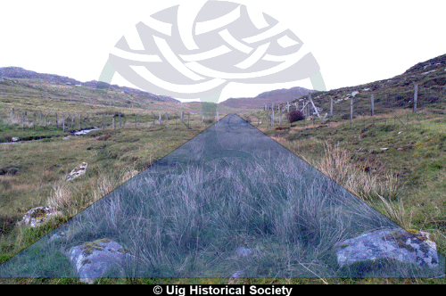
The blue triangle shows the location of the Geshader canal, which ran from the north end of Loch Geshader to the sea. The sea is directly behind the photograper and the stones in the foreground mark the end of the canal, on the shore The channel ran parallel to the burn and was 3-4 metres wide, about 100 metres long and possibly 1/2 metre deep. It was used to transport seaweed from the sea to fertilize the soil on the crofts.
Details
- Record Type:
- Image Details
- Origin Date:
- 23 Sep 1904
- URL:
- https://hebrideanconnections.com/images/UigData/UigPublishable/Geshader/U_GSD_05_0002_bp.jpg
- File Name:
- U_GSD_05_0002_bp.jpg
- Originator:
- Keith Stringer
- Copyright:
- Uig Historical Society
- Record Maintained by:
- CEU