32986: DUN BHARABHAT, LEWIS – DUN (Late Iron Age to Roman Iron Age – 100 BC to 400 AD), MIDDEN (Undated)
Summary:
DUN (Late Iron Age to Roman Iron Age – 100 BC to 400 AD)
MIDDEN (Undated)
Island dun
Location:
NB 09886 35326
Full description:
NB03NE 4 0987 3530.
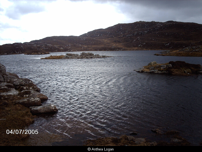
(Area: NB 098 353) The remains of a circular dun occupy the greater part of a small island which lies about 70′ from the extremity of a promontory on the western side of Loch Baravat.
The building rises from the Water’s edge on all sides except on the east where the edge of the loch is about 12′ distant. The dun was much dispoiled about 1911 for the building of an adjoining sheep fank and dipper. The outer face of the wall can be traced for about two- thirds of the circumference, but is quite obliterated on the north, while on the landward side, where it is best preserved, a short section rises to a height of 3′ above the surface of the water.
Overall the dun measures 37′ in diameter. The interior is filled with fallen stones, the mound thus formed rising to a height of 6′. In no place can the inner face of the wall be traced, and the doorway is now obliterated, but on the east side are several long slabs like lintels.
A causeway, with stepping stones on its summit, connects the dun with the land to the east, but it is impossible to say whether or not this has been made in recent times to facilitate the removal of stones for building.
RCAHMS 1928, visited 1914.
This dun, at NB 0987 3530, is oval not circular. The outer wall-face is visible for most of the periphery, rising to a maximum height of four courses on the W side giving an overall measurement of 10.0m E-W by 11.6m transversely. The entrance, filled with tumble, is visible in the E. No trace of the inner wall face can be seen. The causeway is probably contemporary.
Divorced survey at 1/10,000
Visited by OS (R L) 6 June 1969.
Excavation of the S quadrant demonstrated the presence of broch-like features including an entrance complete with a door check and barhole, an inter-mural gallery and the first seven steps of an intra-mural staircase. In the interior, a hearth with flagged surround and the remains of an internal partition comprised of a row of cobbles were recovered. At least three major phases of occupation are represented. Artefacts recovered from the excavation included pottery with typical Hebridean later prehistoric decoration, probable small metal or glass working crucibles, animal bones, shells of several marine species and fragments of cut wood.
D W Harding, P G Topping and T N Dixon 1985.
The site is approached by means of a causeway around 20m long leading out from the W shore of the loch. The dun measures overall approximately 10m SE-NW and 11.5m NE-SW. Its inner and outer walls are on average a metre thick, with a gallery space between of similar width. Removal of surface rubble in 1985 and 1986 very rapidly established the existence of three principal galleries, and a fourth cell adjacent to the dun entrance. The main entrance was over a metre wide at its outer end widening to approximately 1.4m immediately behind the door rebates. A pivot stone indicated the position of the swinging door itself, and two bar holes were contained within the flanking walls on either side. The floor of the entrance was paved, providing a link between the internal stratigraphic sequence and the external paving of the annexe.
The area so far exposed in the interior has produced relatively few internal fittings or furnishings. The centre of the dun, at any rate in its later phases of occupation, was dominated by a hearth of baked clay, defined by edge-set stones, and based upon a raft of hard green clay.
An additional setting of stones just offset from the centre of the dun is also secondary, but there is some evidence that earlier hearths may lie below these features.
One noteworthy feature of the secondary occupation was the discovery around the NW side of the central hearth of an arc of animal teeth, disarticulated from any trace of jaw bones, and disposed individually in a line, or double line for a distance of 60cms to 70cms within the excavated area.
Directly outwith the entrance to the dun a cutting 2m wide down to the water’s edge exposed structural evidence for the use of the Annexe. A short length of cross wall, 1.0m thick and 1.20m from the dun wall, evidently provided protective cover for the dun entrance. Beyond the cross wall, by the water margin, a hearth like feature was defined by a series of edge set stones, while stone facing in the edge of the trench suggested a concentration of structures in the Annexe.
The benefits of the underwater excavation in the surrounding loch has been immediately evident from the volume of material recovered from a relatively small area, and from the fact that this material complemented rather than supplemented the finds from the land based excavation. Animal bone, barely recoverable from the interior, is preserved in quantity underwater, while shells, which were equally scarce within the dun, occur frequently in the underwater deposits. The 1986 excavation also exposed a length of walling, five courses high, and not obviously displaced, the footings of which sit nearly a metre below present water level.
Several decorative features within the pottery assemblage can be paralleled elsewhere, notably applied cordons, ring bosses, averted rims and incised linear decoration, but definition within the typology is not well established.
D W Harding, P G Topping and T N Dixon 1986
no.5
This complex roundhouse site has been excavated by Professor Dennis Harding and Dr Nick Dixon since 1986 (Harding & Armit 1990). The site occupies a consolidated outcrop islet in Loch Bharabhat. the roundhouse dates to the later centuries BC and overlies a number of earlier, submerged structures.
Armit 1992, 41
References:
From the pieces of the past: an introduction to archaeology, Publisher: Univ. of Edinburgh, Dept of Archaeology, From the Pieces of the Past: an introduction to archaeology. 53-5
RCAHMCS. 1928. The Royal Commission on the Ancient and Historical Monuments and Constructions of Scotland. Ninth report with inventory of monuments and constructions in the Outer Hebrides, Skye and the Small Isles, Publisher: HMSO The RCAHMS 9th Report and Inventory: Outer Hebrides, Skye and the Small Isles. 21, No. 72
1985. ‘Dun Bharabhat, Cnip (NB 0987 3533)’, ‘Dun Bharabhat, Cnip (NB 0987 3533)’. 17
1985. ‘Dun Bharabhat (Uig p) island brock & underwater midden’, Discovery and Excavation, Scotland. 63
1986-71111. ‘Dun Bharabhat, Cnip, Lewis’, University of Edinburgh, Department of Archaeology Annual Report. Part No 33. 14-15, no. 2
1986. ‘Preliminary survey of later prehistoric artificial islands on the isle islands on the Isle of Lewis, Outer Hebrides’, Int J Naut Archaeol Underwater Explor. Part No 15. 192
1986. ‘Dun Bharabhat, Cnip, Isle of Lewis, N.W. Scotland (NB 098 353)’, ‘Dun Bharabhat, Cnip, Isle of Lewis, N. W. Scotland (NB 098 353)’. 21-2
1986. ‘Dun Bharabhat, Cnip, galleried island dun’, Discovery and Excavation, Scotland. 49-50
1987-8. ‘Loch Bharabhat, Cnip, Isle of Lewis’, University of Edinburgh, Department of Archaeology, Annual Report. Part No 34. 19-20, no. 9.2
1988-9. ‘Loch Bharabhat, the underwater excavations’, University of Edinburgh, Department of Archaeology, Annual Report. Part No 35. 19-20, no. 8.2
1989-90. ‘Loch Bharabhat, Cnip, Isle of Lewis’, University of Edinburgh, Department of Archaeology, Annual Report. Part No 36. 17
1991. ‘The Atlantic Scottish Iron Age: five levels of chronology’, Proc Soc Antiq Scot. Part No 121. 211 illus 4
Feb 1991. ‘The history of crannog survey and excavation in Scotland’, Int J Naut Archaeol. Part No 20. 4-6
Ian Armit. 1992. CFA, University of Edinburgh Archaeological Field Survey of the Bhaltos (Valtos) Peninsula, Lewis.
1994. ‘Archaeological field survey of the Bhaltos (Valtos) peninsula, Lewis’, Proc Soc Antiq Scot. Part No 124. No.5, 77
Acknowledgement:
Information provided by Western Isles Council Sites & Monuments Record, January 2006.
Record Location
Details
- Record Type:
- Historical or Archaeological Site
- Type Of Site:
- Midden; Dun
- Period:
- Iron Age (pre-Roman) (800-0 BC); Iron Age (Roman) (1-400 AD)
- SMRRecord ID:
- MWE4020
- Record Maintained by:
- CEU
Related Media
Loch Barabhat