32997: DUN BORRANISH, LEWIS
Summary:
ATLANTIC ROUND HOUSE (Early Iron Age to Post-Roman Iron Age – 800 BC to 800 AD)
Complex Atlantic round house, broch/dun
Location:
NB 05032 33255
Full description:
NB03SE 1 0502 3322.
(NB 0502 3322) Dun Borranish (NR)
OS 6’map, (1965)
The dilapidated remains of Dun Borranish or Dun Cuithach, as it is sometimes called, from a mythological giant who, after oppressing the country, was slain by the Fians.
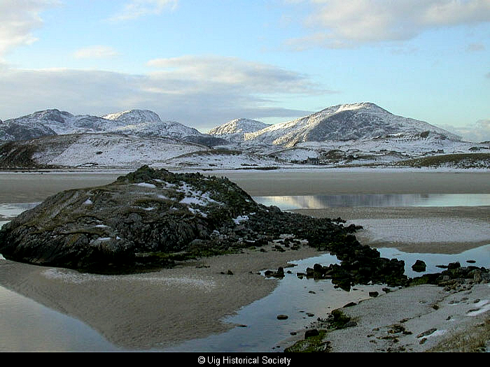
The remains of the building, now a tumbled mass of stones, measure 49′ overall NNE – SSW and 43′ WNW – ESE. The entrance seems to have been on the NNW. Very little of the outer facing of the wall remains in position, but a section towards the NNE, which is straight, suggests that the building has been D-shaped. On the side facing the shore some not wholly ruined wall gives a thickness of 9′ but there is no trace of galleries. The dun is connected with the land by a causeway, 70′ long by 7′ broad, which is laid obliquely across the intervening sand.
RCAHMS 1928, visited 1914.
Fragments of hand made pottery from the site were donated to NMAS by J G Callander.
Proc Soc Antiq Scot 1914.
Dun Borranish – the tumbled remains of a dun which straddles a hog-backed island. The outer wall face can be traced for most of the periphery except in the W where it has been destroyed. The inner wall face is visible occasionally around the E arc and it is particularly well defined in the N and S arcs where two later bothies abut onto it, giving a wall thickness ranging from 3.2m to 2.6m. The entrance is not apparent but could have been in the NNW as suggested by RCAHMS. The causeway is as described.
Midden material containing sherds of thick coarse pottery is visible in several places around the dun.
Surveyed at 1/10,000.
Visited by OS (R L) 28 June 1969.
The monument comprises the remains of an Iron Age fortification, a dun, on a small rocky islet, together with the causeway which links the islet to the nearby shore. The dun is already scheduled, but this rescheduling extneds protection to the causeway and to a small area around the islet.
The dun measures approximately 16m NNE-SSW by 12m overall, and about 7m across internally. The entrance has been to the N, from which side of the islet a curving boulder causeway crosses the surrounding snadflats to the opposite shore. Within th dun’ s walls are traces of several small cellular structurees, and traces of clearly later structures survive outside the walls on the SW side. To the W of the islet are two small piles of stones, which may be evidence of stone-robbing.
The area now to be scheduled is roughly D-shaped, to contain the islet on which stands the dun, the causeway linking it to the shore, the small adjacent piles of stone and an area extending 5m out from the edge of the islet (as defined at high water of ordinary spring tides) on the SW, S, SE, E and NE. On the N and NW, the boundary of the scheduled area is to be defined by the edge of the opposite shoreline (as defined above). The area to be scheduled measures a maximum of 50m NNE-SSW by 45m, as marked in red on the accompanying map extract.
Scheduling Proposal
The entry in the Schedule of monuments … in respect of the monument knwon as Dun Borranish, dun and causeway, Uig Sands … is hereby … amended to describe the area of the scheduled monument as measuring a maximum of 50m NNE-SSW by 45m as shown delineated in red on the plan annexed …
Schedule 3.3.99
References:
Christopher Burgess and Michael Church. Gazetteer of monuments in the 100m coastal zone in Uig, Barvas and the northern part of Lochs, with assessments of the state of erosion of their coastline. Coastal Erosion Assessment, Lewis. Part No parts 1 & 2.
1913-14. ‘Donations to and purchases for the Museum and Library, with exhibits’, Proc Soc Antiq Scot. Part No 48. 11
RCAHMCS. 1928. The Royal Commission on the Ancient and Historical Monuments and Constructions of Scotland. Ninth report with inventory of monuments and constructions in the Outer Hebrides, Skye and the Small Isles, Publisher: HMSO The RCAHMS 9th Report and Inventory: Outer Hebrides, Skye and the Small Isles. 21-2, No. 74
1975-6. ‘Donations to and purchases for the Museum and Library’, Proc Soc Antiq Scot. Part No 107. 333
1976-7. ‘Iron-Age finds from the Isle of Lewis’, Proc Soc Antiq Scot. Part No 108. 375
Acknowledgement:
Information provided by Western Isles Council Sites & Monuments Record, January 2006.
Record Location
Details
- Record Type:
- Historical or Archaeological Site
- Type Of Site:
- Atlantic Round House
- Period:
- Iron Age (post-Roman) (401-800 AD); Iron Age (pre-Roman) (800-0 BC); Iron Age (Roman) (1-400 AD)
- SMRRecord ID:
- MWE4031
- Record Maintained by:
- CEU
Related Media
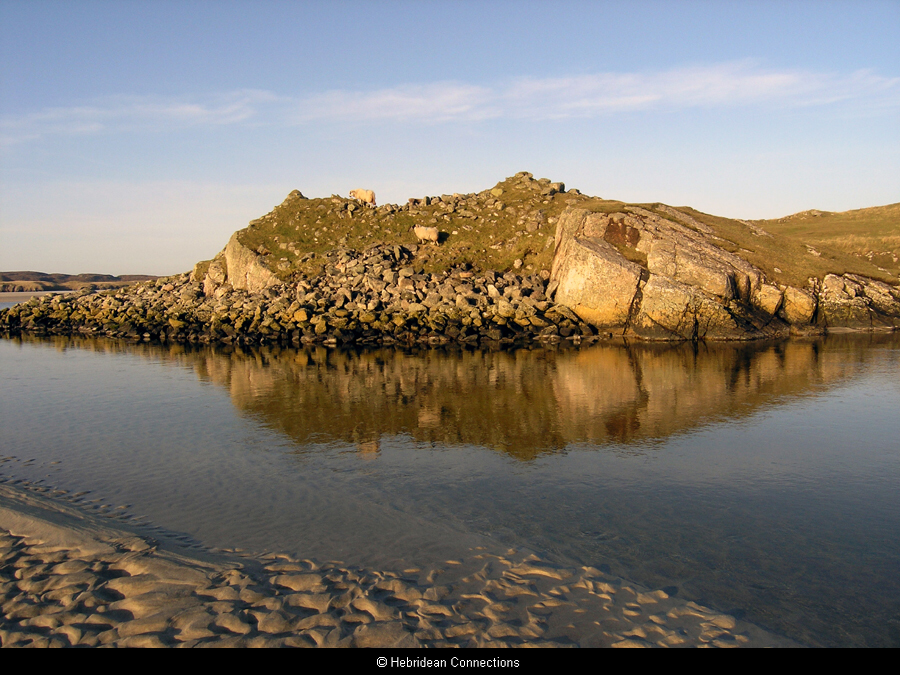
Dun Boranais
Dun Boranais
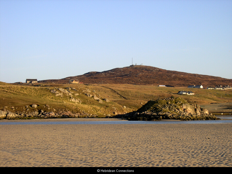
Dun Boranais from the sands
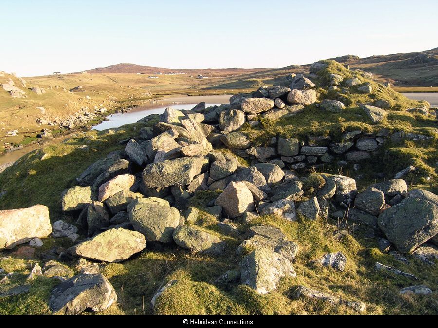
Dun Boranais, interior