32207: GUINNERSO
Summary:
MOUND (Undated)
STRUCTURE (Undated)
SETTLEMENT (Undated)
Potters Workshop (Undated)
SITE (Undated)
Multi-period settlement with ceramic production
Location:
NB 034 362
Full description:
NB03NW 6 034 362
NB 050 360 In spring 1995 a team from the Department of Archaeology, University of Edinburgh carried out fieldwork in a 1000 hectare area between Uig sands and Aird Uig in Uig parish. The presence of the large machair area around UIg sands within this survey area lead to the examination of the state of coastal erosion not only on the machair but also along the cliff areas to the N and W along the Aird Uig Peninsula.
NB 0335 3615 Cellular settlement.
A full report will be lodged with the NMRS.
Sponsors: Department of Archaeology (University of Edinburgh), Russell Trust, Council for British Archaeology, Archaeology Society, University of Edinburgh.
C Burgess and M Church 1995.
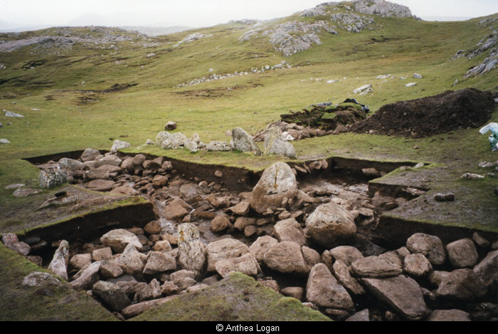
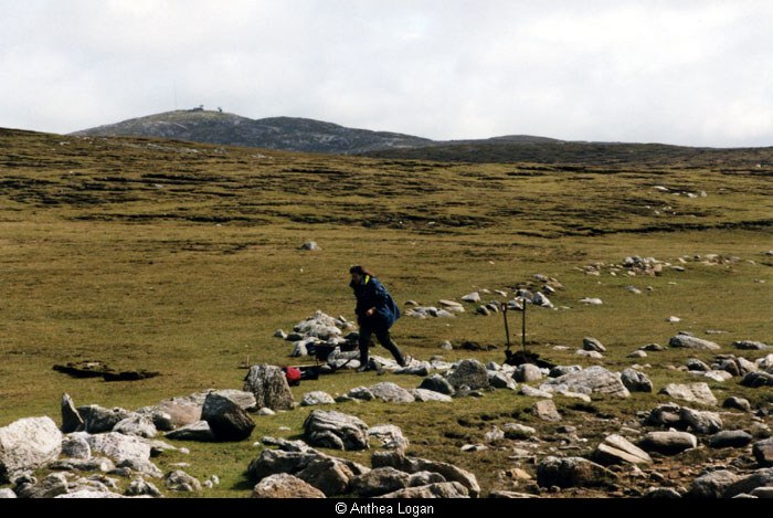
NB 034 362 Located 3km to the NW of the township of Crowlista and 2km to the SW of the township of Aird Uig on very remote sea cliffs are the remains of a relict landscape. Centred around the partially drained Loch Ruadh Guinnerso are a series of features including walls, cultivation, clearance cairns, cellular structures and several possible burial cairns that have survived due to the remoteness of the site.
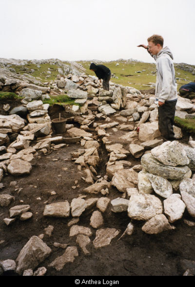
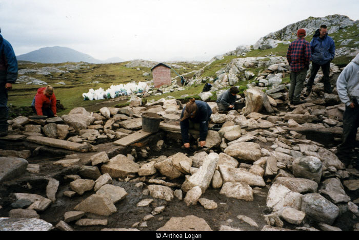
To the S of the loch is a concentration of cellular structures on the saddle of a ridge. This comprises a mound of stones up to 2m in height and 11m in diameter with smaller ?satellite? circular features. The main stone mound was visibly multi-phase, the latest of which was a small rectangular drystone building with a well-paved floor and single W entrance. Excavations were centred around the main stone feature with trenches being opened around the SE edge of the mound and on its summit.
In the SE quadrant of the mound is a series of structures including a rectilinear stone platform with hearth. Underlying these is a flue or floor drain associated with an overlying extensive hearth area and lengths of walling. The earliest visible structure to date is rectilinear with stone walls often utilising the quarried bedrock outcrop to the S.
Excavations on top of the mound revealed an underlying series of sub-rectilinear structures with two opposing elongated entrances; the earlier of these had a pair of alcoves measuring c 0.3m wide by 0.8m deep in the N wall. Large amounts of peat ash were deposited on the floors of these structures and within one of the alcoves. Examination of the two entrances seems to indicate that the W one was used solely for entrance as no peat ash was found within it, while the E one was used primarily for egress as quantities of peat ash were found trampled into the floor surface.
Test excavations in a single cell to the E of the main mound indicated that it was of the same basic construction; a cellular form that was repeated elsewhere in the landscape.
Large quantities of pottery were recovered including extremely fine hand-made wares and fragments of vessels that may be skuemorphs of bronze vessels. These and other artefacts including a slate burnisher and several quartz tools, among which was a tanged arrowhead, seem to point to a Late Bronze Age date for the contexts excavated. The large quantities of carbonised materials recovered will provide radiocarbon dates in due course.
Core samples were also taken from the loch, where a depth of up to 5.25m (much of it laminated) was reached, with the aim of providing a climatic record for the prehistoric period in the vicinity. It is hoped that this unique landscape will be the subject of future investigation to help characterise all aspects of this elusive period in the Western Isles.
Sponsors: Historic Scotland, Monroe Fund – Edinburgh University, Russell Trust, Edinburgh University Archaeology Department.
C Burgess, S Gilmour and M Church 1996
NB 034 362 Excavations on the Guinnerso landscape examined the main focal point of activity identified during 1996 (Burgess, Gilmour and Church 1996). The curvilinear building with northern ‘bays’ was excavated to primary levels and found to incorporate a central post-hole and several phases of construction. This structure was then removed. The northern satellite Cell A was partially excavated and found to incorporate a late 19th-century rectangular shieling overlying a larger, more curvilinear structure of indeterminate function which may have incorporated corbel architecture.
A trench was cut across two relict agricultural rigs and soil micromorphology samples were taken. During this excavation the sub-peat remains of two roughly built walls and a possible ?platform? of stones were discovered. These probably date to the later prehistoric period and represent the earliest excavated remains on the site to date. Further excavation in eastern satellite Cell B produced evidence for metalworking including slag, crucible fragments and a possible piece of tuyere. Finds from this season’s excavation include a generous pottery assemblage, mainly plain, but including some decorated pieces. Preliminary assessments place the majority of excavated features on this site somewhere in the early medieval period although radiocarbon dates are awaited.
Excavation of further features in the relict landscape revealed stone platforms on an enclosed promontory overlooking Loch Ruadh Guinnerso, and a well-built stone pavement associated with orthostats previously believed to mark the location of graves. Detailed surveys of several of the monuments in the area were carried out, and peat monoliths were taken.
Sponsors: Historic Scotland, Edinburgh University Archaeology Department, Abercromby Trust Fund, Carnegie Trust, Small Project Grant – Edinburgh University.
C Burgess, M Church, A Heald and S Gilmour 1997
References:
1995. ‘Uig Sands to Aird Uig, Isle of Lewis (Uig parish), survey’, Publisher: Council for Scottish Archaeology, Discovery and Excavation, Scotland. 111
1996. ‘Guinnerso (Uig parish), relict landscape’, Publisher: Council for Scottish Archaeology, Pubished: 1997 Discovery and Excavation, Scotland. 111-112
1997. ‘Guinnerso (Uig parish), relict landscape’, Publisher: Council for Scottish Archaeology, Pubished: 1998 Discovery and Excavation, Scotland. 85-86
Acknowledgement:
Information provided by Western Isles Council Sites & Monuments Record, January 2006.
Record Location
Details
- Record Type:
- Historical or Archaeological Site
- Type Of Site:
- Settlement; Structure; Site; Mound; Pottery Workshop
- SMRRecord ID:
- MWE109409
- Record Maintained by:
- CEU
Related Media
Excavations at Gunnerso
Excavations at Gunnerso
Excavations at Gunnerso
Excavations at Gunnerso