31393: LOCH NAN RITHEANAN, LEWIS – DYKE (Undated), SHIELING (Undated)
Summary:
DYKE (Undated)
SHIELING (Undated)
Shielings and boundary dykes shown on 1st ed OS map 1852
Location:
NB 354 236
Full description:
NB32SE 24 354 236
What may be two roofed shieling-huts and two lengths of boundary dyke are depicted on the 1st edition of the OS 6-inch map (Ross-shire, Island of Lewis 1852, sheet 32). The dykes are shown on the current edition of the OS 1:10000 map (1974).
Information from RCAHMS (SAH) 12 August 1997
Acknowledgement:
Information provided by Western Isles Council Sites & Monuments Record, January 2006.
Record Location
Details
- Record Type:
- Historical or Archaeological Site
- Type Of Site:
- Dyke; Shieling
- SMRRecord ID:
- MWE132150
- Record Maintained by:
- CECL
Related Media
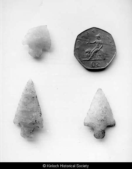
Axe heads found at Loch nan Ritheannan, Keose